canal du Midi avec bateau et nouvelles plantations

A brief overview of the canal du Midi:
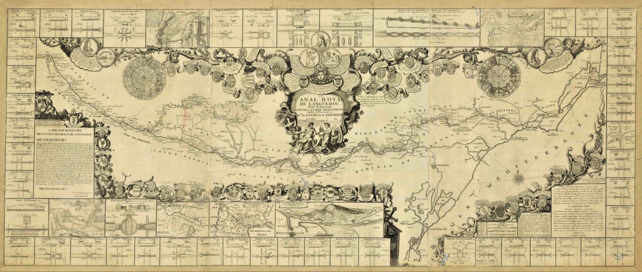
map, dates and key figures

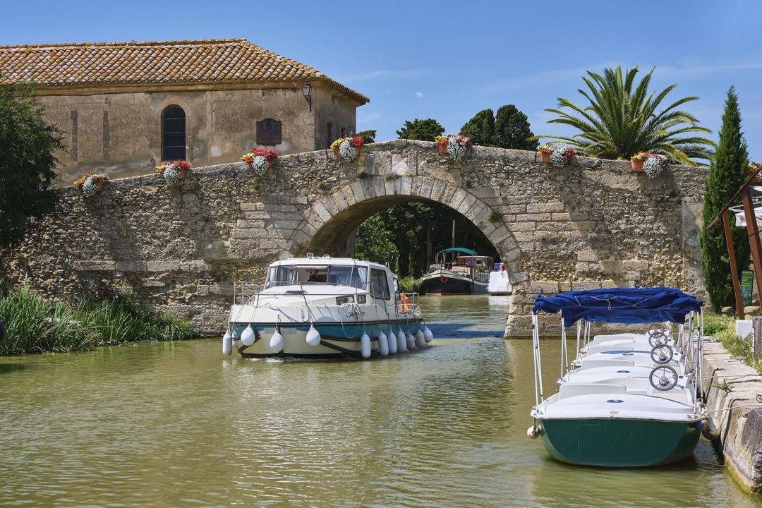
The Canal du Midi was built during the reign of Louis XIV, between 1667 and 1681, and is one of the oldest canals in Europe that is still in operation.
It has made the age-old dream of creating an inland connection between the Atlantic and the Mediterranean come true.

The Canal du Midi is an unmissable tourist attraction thanks to its ingenuity, fascinating history and the fact that it is dotted with impressive engineering structures. Here is some key information about this one-of-a-kind canal, including dates, key figures, map, iconic people and impressive engineering structures!

Where does the Canal du Midi start and finish?

The Canal du Midi crosses the Occitanie region of France. It originates in Toulouse and then runs all the way to the Thau lagoon in Marseillan, and then on to the Mediterranean Sea via Sète. The Canal du Midi is 240 km long and winds through 4 French departements: Haute-Garonne, Aude and Hérault, and the Tarn for the water supply system. 

The UNESCO World Heritage Site of the canal du Midi is made up of the canal itself as well as the water supply system from the Montagne Noire, and the 18th century extensions (the Brienne, Jonction and La Robine canals).

The Canal de Garonne, connected to the Canal du Midi and built between 1839 and 1856, provided a connection from Toulouse to Castets-En-Castillon, around fifty kilometres from Bordeaux, without having to go along the unpredictable Garonne, which was the case up until then. The Canal du Midi together with the Canal de Garonne form the Canal des Deux Mers

Route of the Canal du Midi Unesco

Route of the Canal du Midi Unesco

How long is the Canal du Midi?

The official length of the Canal du Midi UNESCO World Heritage Site is 360 km, including:

  • 240 kilometres
    from Toulouse
    to Marseillan

  • 81 kilometres
    of water supply system in the
    Montagne Noire (channels)

  • 37 kilometres
    for the Jonction and La Robine canals

  • 1.5 kilometre
    for the Canal de Brienne
    in Toulouse

  • 0.5 kilometre
    additional section between Hérault
    and the Agde round lock

How wide is the Canal du Midi?

The surface width of the Canal du Midi is 18 m and the bed width is 10 m, with a depth of 1.90 m. 

The history of the Canal du Midi

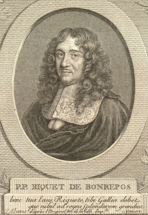
Who built the Canal du Midi?

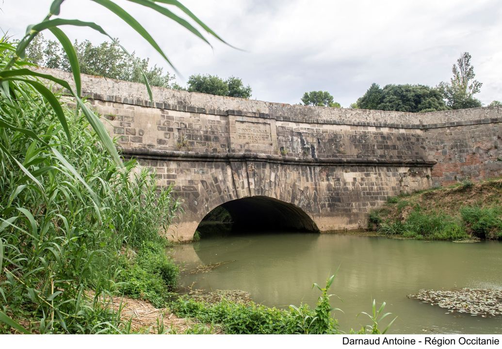
The man responsible for the Canal du Midi is Pierre-Paul Riquet. Thanks to his talent and knowledge of hydraulic systems, he came up with a solution to supplying this landmark with water, an issue that nobody else had managed to resolve.

This system, which is still in operation today, carries the water from the streams and rivers in the Montagne Noire to the Seuil de Naurouze, the highest point of the canal, from where this water then flows to the Mediterranean on one side, and the Atlantic on the other.

Pierre-Paul Riquet 

A symbolic project of Louis XIV's reign

The Sun King became aware of Riquet's dream of connecting the Mediterranean to the Atlantic thanks to Jean-Baptiste Colbert, Louis XIV's influential controller-general of finances.  All three men were ambitious and wanted to make their mark on history and ensure France was to become a major power.

On 14 October 1666, Louis XIV appointed Pierre-Paul Riquet as lead engineer in charge of building the Canal Royal du Languedoc - renamed the Canal du Midi after the Revolution - between the Thau lagoon and Toulouse.

How long did it take to build the Canal du Midi?

Construction work for the Canal du Midi lasted 14 years, from 1667, when work began, up until the very first boat sailed there in 1681.
And up to 12,000 workers were involved!

Vauban contributed some improvements to Riquet's design

In the months following the inauguration, some flaws started to appear. Vauban was called upon by the King to roll out some significant construction work from 1687 to 1694 to consolidate Riquet's masterpiece.  

Building the Canal du Midi

The exceptional engineering structures along the Canal du Midi

There are engineering structures dotted along the Canal du Midi. In total, there are no less than 328 of them, which represents around one structure every kilometre: 142 bridges, 67 navigable aqueducts and aqueducts, 1 tunnel, 79 locks and a number of spillways and weirs, water inlets, etc.

Some of these engineering structures are quite remarkable:  

The Canal du Midi, a landmark with UNESCO World Heritage status

An ingenious water supply system, never-before-seen dimensions and a great number of engineering works... The Canal du Midi is one of the greatest achievements in European construction works of the 17th century!  

This exceptional example of scientific, architectural and landscape heritage was granted World Heritage status in 1996 by UNESCO. The Canal du Midi, its water supply system and extension canals - Brienne, Jonction and La Robine - have all been added to the list of World Heritage sites. 

This status means that it is essential to safeguard, raise awareness and pass this landmark on to future generations!

Navigation
and the other uses of the Canal du Midi?

The Canal du Midi was originally designed to transport goods and passengers, but the uses of the canal have evolved over time, and thanks to innovations. Today, the Canal du Midi is essentially used for river tourism, irrigation and leisure activities (cycling, walking, etc.). The Canal du Midi is France's leading river tourism destination, with almost 30% of national visitor numbers and 70,000 boat passengers per year. This activity is going from strength to strength with an increasing interest in exploring the canal by boat!  

The former towpaths have been converted into cycle paths and footpaths which are attracting more and more visitors who are looking to explore the canal on foot or by bike

Did you know?

Today, the main use of the canal is to provide the water needed for crops. 60% of the water flowing through the canal is used in irrigation systems on nearby farms.

Managing the Canal du Midi today

In 1991, Voies Navigables de France was created. This public establishment is in charge of the maintenance, operation and development of navigable canals and rivers. It is also responsible for ensuring inland public waterways are showcased and developed correctly. It contributes to sustainable development and urban planning in the local areas, in partnership with local authorities and the French government.  

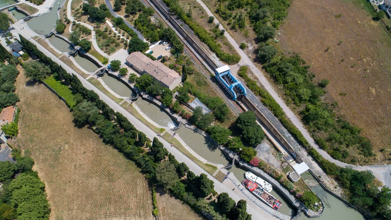
Since it was first created, the Canal du Midi has never stopped evolving. Even today, the canal is constantly being modernised with new installations, that ensure optimised hydraulic management for example.

Since 2006, the plane trees providing shade along the banks of the Canal du Midi have been suffering from canker stain, which has caused a great number of these trees to die. In light of this, Voies Navigables de France is replanting the areas affected by the disease thanks to support from partners and sponsors, in an effort to preserve the identity of the canal scenery.

The Canal du Midi, are you tempted?