Plage La Redoute, Portiragne - OT Cap d'Agde Méditerranée -CRTL Occitanie

Portiragnes, where the canal edges closer to the Mediterranean

The village of Portiragnes and seaside resort are 10 km after Béziers, towards the Mediterranean.  

Coastal scenery alongside the canal

Portiragnes single lock opens onto the Agde canal pound, downstream. This area is very typical of the Languedoc coastline. From this lock onwards, the canal flows at just 1 metre above sea level. It flows alongside the wetlands where the former saltmarshes were (La Grande Maïre). The wildlife is fascinating (bulls, horses, wading birds, amphibians, reeds, etc.) here and there are also pine forests. This area is a popular location for campsites.

This region of flat and humid terrain is an issue when it comes to evacuating the excess waters of the canal because this section is also a flood storage area for the Hérault and Libron rivers in particular. At the Agde canal pound, there are 23 surface spillways to evacuate excess waters into wetlands between the canal and the sea.

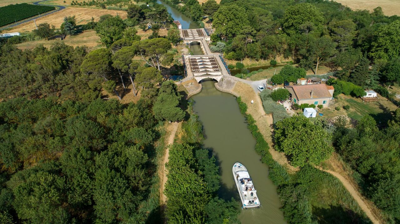
You'll see a great example of these spillways 1 km downstream from Portiragnes lock. These spillways were built next to the towpath on the right banks and some of them are equipped with arches over the top so that horses towing the boats up until the early 20th century had a dry passage over the structure. 

7 kilometres downstream from Portiragnes lock, the crossing with the Libron river caused problems for navigation for a long time. In the 1850s, the construction of the famous Ouvrages de Libron meant that navigation was no longer affected by climatic events. 

A 'canalet' (branch) to utilise a stone quarry

In this section, 500 m after Cassafières port, the branch known as the Canalet de Roucaute links the Canal du Midi to the nearby basalt quarries.

This hard stone was used to build many of the engineering structures on the canal. In the 18th century, the Roque-Haute quarry belonged to the Marquis of Villeneuve (not yet Les-Béziers).

The owners of the canal wanted to be able to utilise this quarry and so in 1772, they authorised the marquis to water the grounds of his Château de Villeneuve and in return, they were granted access to utilise the quarry.

A 'canalet' (branch) was therefore built to allow the barges to get as close as possible to the quarry face. Thanks to this agreement, basalt was used in the region of Toulouse for any improvement work on engineering structures, especially for the top stones on the lock walls that were often damaged by friction from ropes.

Portiragnes, seaside resort and mooring point

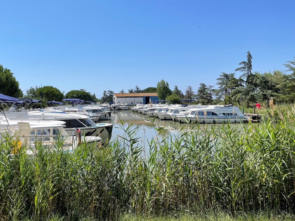
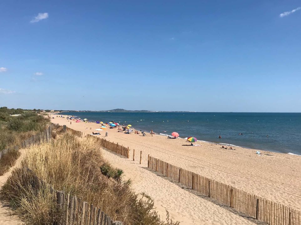
Cassafières port was created in the 1980s at an inner harbour very close to campsites, and visitors can come and hire a boat here to explore the canal and visit the coastal plain of Languedoc. The vast La Redoute sandy beach straddles the towns of Portiragnes and Vias, 2 km from Cassafières port.  

For the past 15 years, Portiragnes has hosted the CanalissimÔ festival late June-early July on the canal, in the surrounding area of the lock. 

Contact Portiragnes Tourist Office


Contact
and information

OFFICE DE TOURISME DE PORTIRAGNES
Place du Bicentenaire
34420 PORTIRAGNES

Tél : +33 4 67 90 92 51

Tél : +33 9 75 80 72 12

Email

Website

Calculate your route