
Maps and brochures
To help you organise an exploration of the Canal du Midi that suits your needs, here are various maps of the Canal du Midi: an interactive map, a map of the canal for cyclists, a map for boaters, a UNESCO map, as well as some downloadable guides!
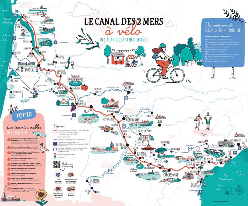
Online map on the Canal des 2 Mers à Vélo website
The Canal des Deux Mers (Two Seas Canal) is made up of the Canal Latéral à la Garonne from the Atlantic to Toulouse, then the Canal du Midi from Toulouse to the Mediterranean. On the Canal des 2 Mers à Vélo website, discover the 750-km route from the Atlantic to the Mediterranean, stage by stage.
The map opposite can be downloaded in digital format (pdf). On the back, each section includes tourist information to help you organise your itinerary.
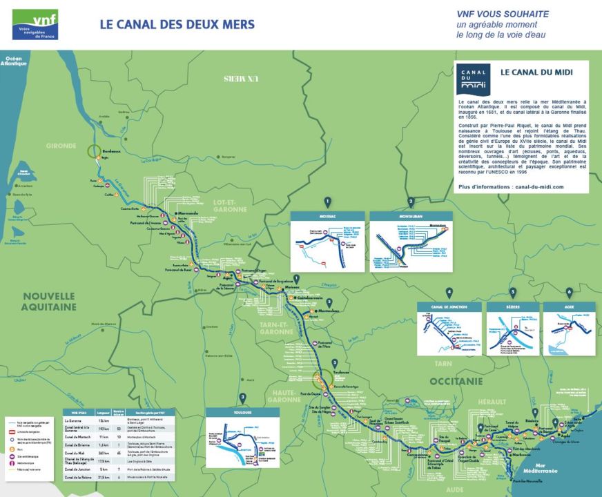
While travelling along the Canal du Midi by boat, it is very useful to have an accurate map showing all the locks, ports and moorings!
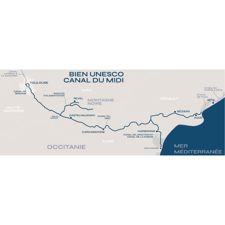
This map shows the boundaries of the Canal du Midi as a UNESCO World Heritage Site.
The listing concerns the structure in all its components, including:
- the Canal du Midi itself, from Toulouse to the Étang de Thau (240 km)
- the Canal de Jonction and the Canal de la Robine, which link the Canal du Midi to Port La Nouvelle (36.5 km)
- the Montagne Noire supply system, which provides water for the Canal du Midi at the Seuil de Naurouze (76 km)
- the Canal de Brienne in Toulouse, which provides a link with the Garonne (1.5 km)
- a section of the Hérault river at Agde (0.5 km).
A documentation to know everything about the Canal du Midi
This documentation presents the property of UNESCO canal du Midi in its different aspects (history, management, uses, biodiversity...) and details more specifically 25 places distributed on its linear, arranged on a map.
Documentation "Canal du Midi, world heritage" (ES) (5Mo, pdf)
