Bages lake and Sainte-Lucie nature reserve
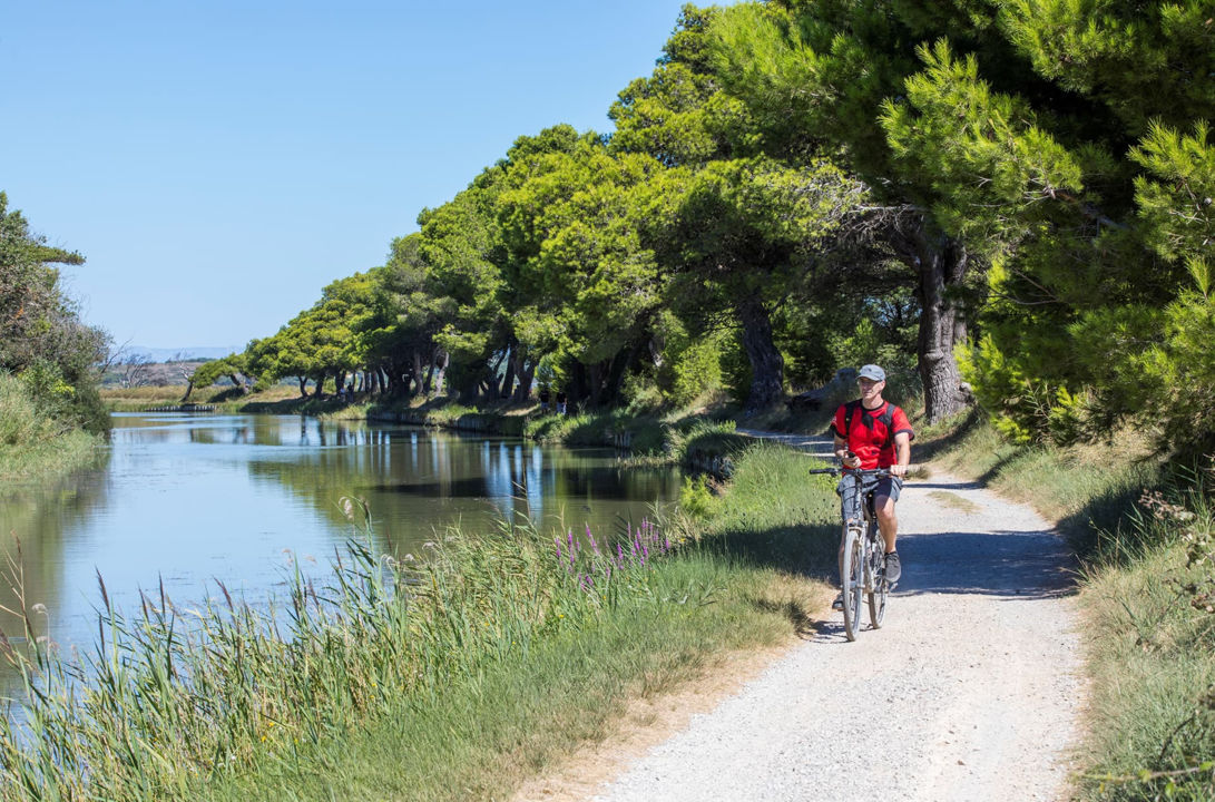
The Canal de la Robine crosses an unspoilt area past Bages lake and through Sainte-Lucie nature reserve. You can walk or cycle along the towpath through this natural environment.
The area of Bages lake (also known as Sigean lake) and Ayrolle lake is just as you would expect when you know the local history of the Languedoc coastal plain.
The characteristics of the lakes of Languedoc between land and sea, meant that they were used from as early as Antiquity as defence systems (man-made and natural). They were used as shelter for a number of activities, particularly related to maritime and land-based trade.
Over the years, the territory between the former course of the Aude river, north of Narbonne (current Canal de la Robine) and Bages lake has experienced the colonisation of Montlaurès hill during protohistory, the foundation of the city of Narbonne and the construction of villas in Roman times. The port facilities at the lake are believed to be the most significant constructions from the Roman Empire, after Ostia Antica near Rome. Archaeological remains of these facilities were discovered in the surrounding area of La Nautique and the Domaine de Mandirac.
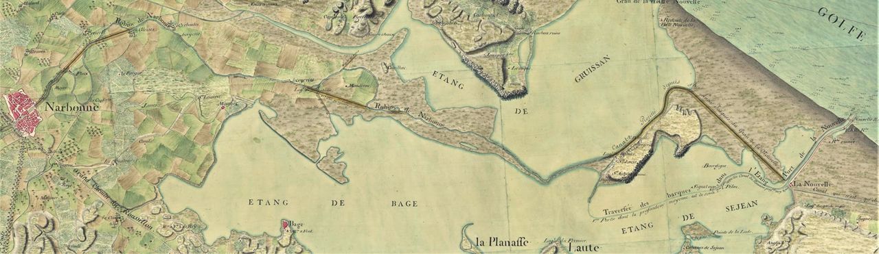
In 1316, the Aude river flooded the city of Narbonne and diverted its course north. Suddenly deprived of their outlet to the sea, the locals of Narbonne took to transforming the former course of the Aude into a canal. This Canal de la Robine was around thirty kilometres long and joined onto the Aude at Grau de la Nouvelle, via the lakes.
Due to siltation, any trade between Narbonne and the sea fizzled out.
A revival thanks to the arrival
of the Canal de la Robine
Narbonne had to wait until the end of the 17th century and Vauban's project, led by his engineer Antoine de Niquet to get back its outlet to the sea via the Canal de la Robine which followed the former course of the Aude river, winding around the lakes.
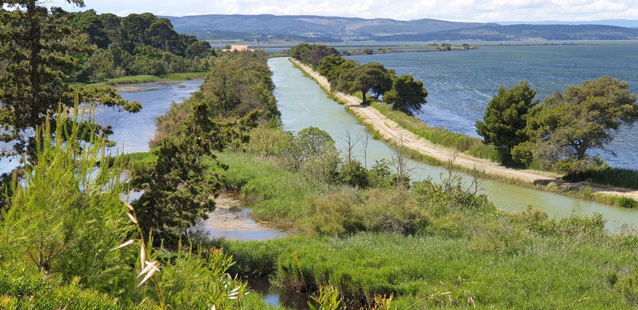
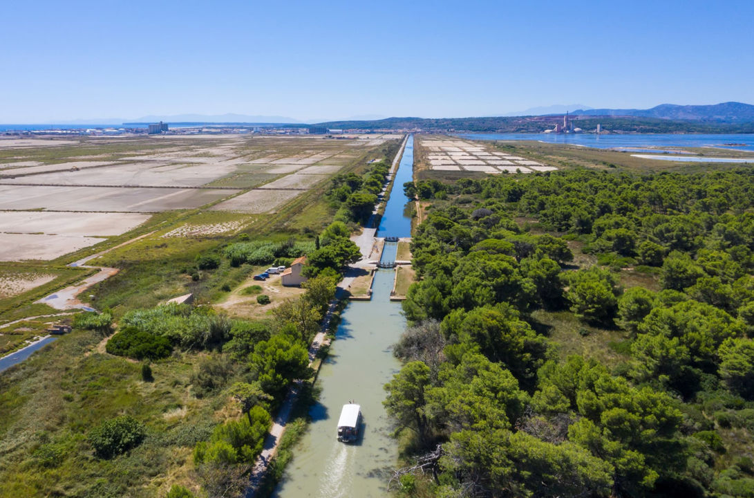
After the lake and before arriving at Port la Nouvelle, the canal passes around Sainte-Lucie hill on the north side until it reaches the lock of the same name, with a mobile bridge providing access to the island.

Saint-Lucie nature reserve covers a surface area of 825 hectares and includes the following three ecological sites:
- The Ile de Sainte Lucie itself
- The ancient Sainte Lucie salt marshes
- The Vielle Nouvelle beach
This area benefits from a warm and dry Mediterranean climate with sometimes extreme or even violent climatic events such as drought, torrential rain and storms.
It is also home to many plant and animal species.