The Canal de la Robine,
from Moussoulens to the Mediterranean
The Canal de la Robine is 31 kilometres long and provides a link between the Canal du Midi and the Mediterranean Sea via Narbonne. It begins in Moussoulens just after the Canal de Jonction, passes via Narbonne and ends in Port-La-Nouvelle.
The Canal de Jonction and Canal de la Robine are both a part of the Canal du Midi UNESCO World Heritage Site.
Canal de la Robine
The Canal de la Robine is 31.4 km long
The Canal de la Robine begins at its highest point, on the banks of the Aude river, which is also its water supply.
The Canal de Jonction gets its water supply from the Canal du Midi, and is further upstream, proving the link between this point and the Canal du Midi.
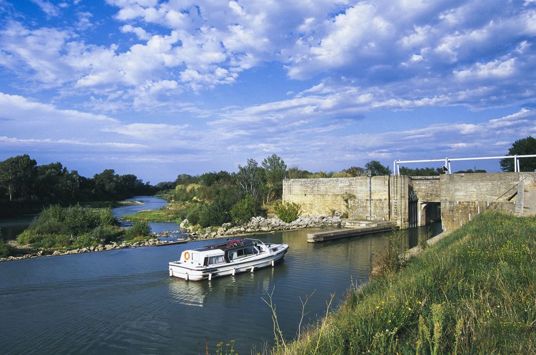
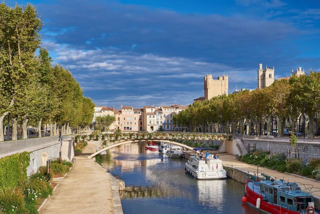
The departure point of the Canal de la Robine is Moussoulens lock with safety gates that protect Narbonne in the event of flash flooding. In Narbonne, the canal passes under the Pont des Marchands, one of France's rare covered bridges. It then flows past Bages and Sigean lakes and Sainte-Lucie nature reserve. It ends in Port-La-Nouvelle where it flows into the Mediterranean.
The towpath has been converted into a greenway route from the centre of Narbonne to Port-la-Nouvelle.
The longstanding history of the Robine
The Canal de la Robine flows along the former course of the Aude river that the Romans used to sail from Narbonne to the sea. After a brutal change in course in the 14th century, the river has since flowed further north, towards Vendres lake. The former course was not deep enough for navigation and so it was used to supply water to the fountains and mills in Narbonne.
The Canal du Midi was such a boost for trade in the 17th century that in 1686 it was decided to make the Canal de la Robine navigable and therefore provide a link between Narbonne and the Canal du Midi.
Work on the Canal de la Robine over the years
At the end of the 17th century, to make it possible to sail on the Canal de la Robine, the winding route of the former course of the river Aude was divided into sections and three locks were built to ensure the right depth in the navigation channel:
- Raônel
- Gua
- La Charité.
This last lock in the centre of Narbonne made it possible for boats to reach the Port des Barques in the town centre.
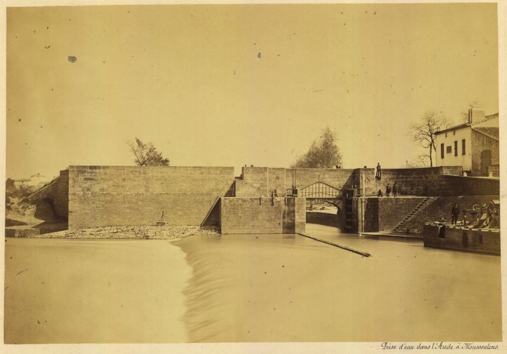
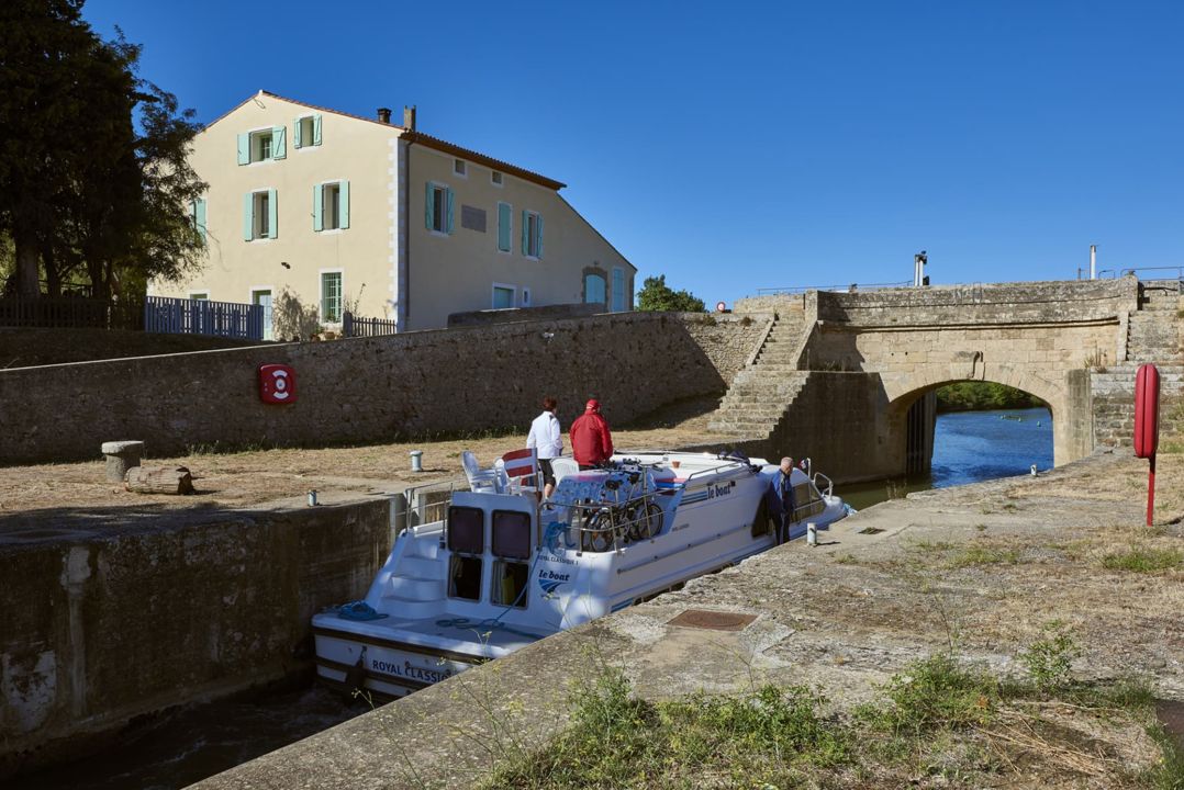
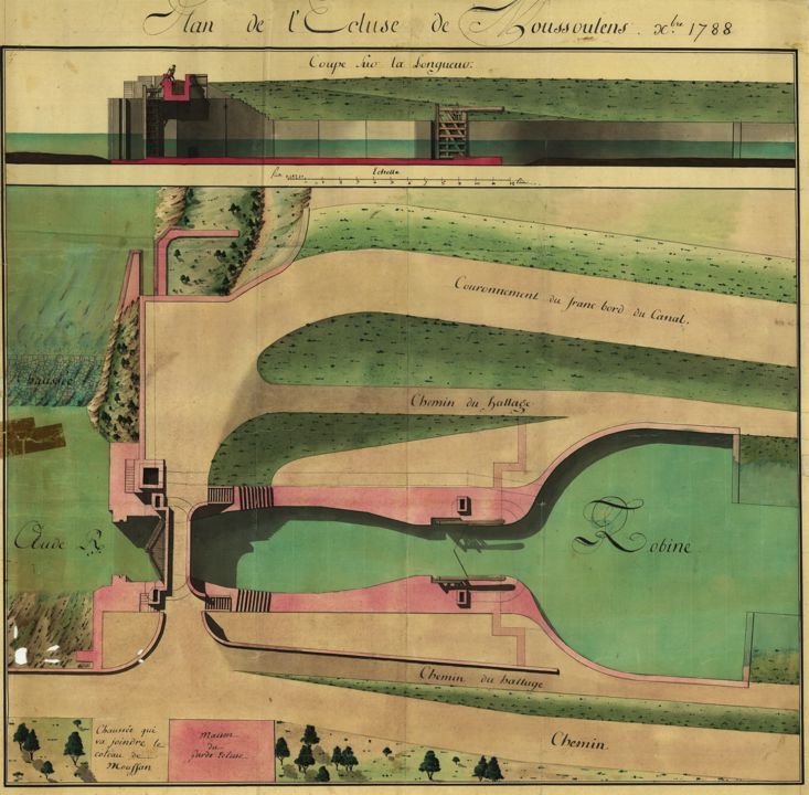
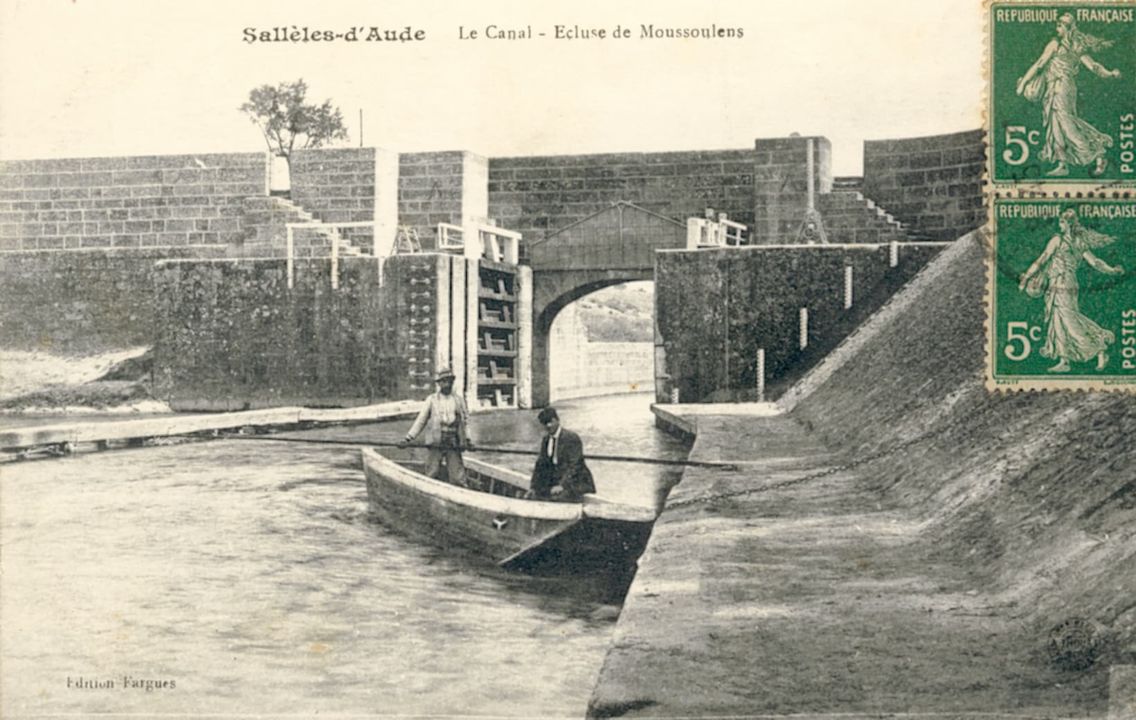
Moussoulens lock was created later, at the beginning of the 18th century. It is next to the dam on the river Aude that diverts the volume of water needed for the canal to operate. The purpose of this structure was to contain the waters of the Aude when levels were high, to avoid causing any damage for the canal. That is why it looks like a fortified castle, it was built to protect!
Initially, there weren't any locks between Narbonne and the sea. Navigation was often challenging here and Mandirac lock was the first one to be built in 1806 as a solution to the lack of depth. Then in 1872, Sainte-Lucie lock was built, making navigation easier between Narbonne and Port-La-Nouvelle.
In the 1980s, all the locks on the Canal de Jonction and Canal de la Robine were extended by ten metres so that barges up to 38.50 metres long could pass through.
Moussoulens
A lock and safety gates to prevent flooding
Moussoulens lock marks the entrance of the Canal de la Robine on the Aude river, and it was built between 1690 and 1724 by engineer Antoine de Niquet. This canal had a direct link to the Aude river, and so experienced the same variations in water level. Safety gates were therefore built to isolate the canal from the rising water levels of the Aude, and therefore avoid flooding in the towns located downstream, including Narbonne.
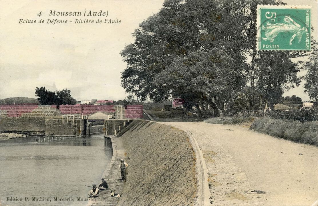
After a significant rise in water levels in October 1940 which left the lock underwater and Narbonne flooded, the height of the lock gates was increased by around 4.60 m using concrete.
In 1978, the length of the lock was extended in accordance with the Freycinet gauge (length of 40 m) so that longer barges could pass through.
Today, this lock is part of an anti-flood protection mechanism which also includes dams built on the right banks of the Canal de la Robine to protect Narbonne. The canal creates a gap in this system and so the purpose of the safety gates is to compensate for this.
Moussoulens safety gates for protection from flooding
The safety gates have 3 modes of operation depending on the water level on the Aude river:
• Situation 1: Water levels on the Aude are normal, there is no need to isolate the canal from the river. The upstream and downstream lock gates are open. The lock is left open and boats can pass through as if it were not there.
• Situation 2: Water levels on the Aude have risen slightly, the lock is closed to isolate the canal from the river, while ensuring navigation goes ahead as normal.
• Situation 3: Water levels on the Aude are at their highest and the canal must be isolated from the river. It is too dangerous to allow boats to pass through the lock and so the two sets of gates remain closed.
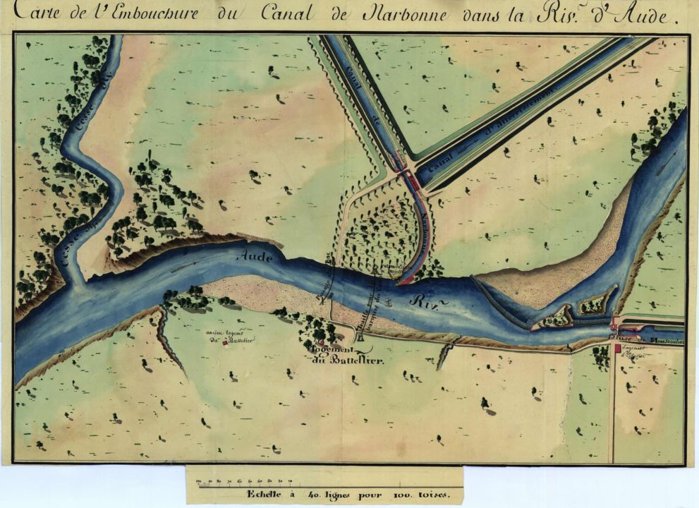
The dam on the Aude
To sail between the Canal de Jonction and the Canal de La Robine, there's a compulsory section on the Aude river of around 500 m. A dam creates a basin on the river to guarantee enough depth for boats to navigate.
Up until the early 20th century, some boats were still towed along by horses on the towpath. A ferry cable was set up between either bank to help skippers get across this section. These structures are still on either side of the Aude river today.